
Plano ZIP Code Directory Coverage
Collin County's official ZIP map identifies seven commonly listed Plano ZIPs and a shared Plano and Weston postal area. The map is useful for choosing a search area, but the county labels it illustrative and unsuitable for boundary disputes. The descriptions below follow the coverage notes documented in the research rather than assigning precise neighborhood lines that the source does not publish. Post-office or station names were not located in the inspected official sources, so they are intentionally identified as such. Use USPS for the current postal result of an exact address.
| ZIP | Areas covered | Post office | Research note |
|---|---|---|---|
| 75023 | Northwest-central Plano neighborhoods and addresses | Not identified in sources | Shown on the county ZIP map and county tax-office examples. |
| 75024 | Plano, especially northwest and Legacy-area postal geography | Not identified in sources | Postal area, not municipal-boundary proof. |
| 75025 | North and northeast Plano, including Legacy-area postal geography | Not identified in sources | A sample eTRAKiT permit uses this Plano ZIP. |
| 75074 | East and central Plano, including historic-downtown postal geography | Not identified in sources | Used by the County Clerk Plano office and HOA certificates. |
| 75075 | Central and south Plano postal geography | Not identified in sources | Appears in HOA and county tax-office examples. |
| 75093 | West Plano postal geography | Not identified in sources | Appears in tax-registration and HOA examples. |
| 75094 | East and northeast Plano postal geography | Not identified in sources | Shown on the county map and a Woodlands of Plano HOA example. |
| 75097 | Shared Plano and Weston postal geography | Not identified in sources | Verify exact addresses with USPS and city GIS. |
These ZIP descriptions support an address search only. They do not establish a city limit, parcel owner, household member, school district, or jurisdiction. A full street address, the parcel record, and the municipal boundary layer answer those separate questions. The county map itself makes the distinction important: it is a useful overview of postal geography, but it is not designed to settle parcel-by-parcel questions at a city edge.
Plan a Plano ZIP Code Search
A ZIP can focus the first pass, but it cannot produce a public anonymous directory of people. Begin with the physical address and use USPS to confirm the postal assignment. Then locate the parcel in CCAD or GIS and preserve the situs address, legal description, property ID, and city context. My Voter Portal accepts ZIP as part of an identified person's name, county, date-of-birth, and ZIP lookup. It is not a ZIP-wide resident list. The paid Collin County voter file has registered and mailing addresses, but it has election-law restrictions and should not be turned into a street census.
- Enter the complete address in USPS and retain the recognized city name and ZIP returned for that address.
- Plot the address in Plano GIS or CCAD GIS to compare its location with the city polygon and parcel context.
- Search CCAD by address, owner, or other visible criteria. If a current ZIP field is not visibly offered, do not assume a ZIP-wide property search is available.
- For an identified person, use My Voter Portal's name, Collin County, date-of-birth, and ZIP inputs, then confirm any match with another appropriate official source.
- Use the legal description in the County Clerk deed search when the question shifts from postal geography to recorded land history.
Once a ZIP has narrowed the likely area, the Plano Street Directory has the address-by-address record path. It is more useful for a named street than trying to infer an entire block from a postal code.
USPS Fields for a Plano ZIP Code
USPS ZIP Lookup offers three documented ways to check postal geography: By Address, By City and State, and Cities by ZIP. The exact-address option is the strongest practical route because postal results depend on the address entered. USPS warns that its result does not confirm that a person or company is at the address. It confirms postal assignment only. That distinction keeps a ZIP code directory useful without converting postal data into a claim about an occupant.
| USPS mode or field | Type | Required | Format or result use |
|---|---|---|---|
| By Address | Search mode | Choose mode | Best for one complete address. |
| Street Address | Text | Yes in By Address | Enter the physical street address. |
| Apt, Suite, Other | Text | No | Optional unit detail when applicable. |
| City and State | Text or selector | Yes for city-state mode | Both are required in that search path. |
| ZIP | Text | Yes for Cities by ZIP | Five-digit postal input. |
| Find | Button | After inputs | Returns the postal lookup result. |
USPS online lookup is not the only channel. Postal support and a retail counter are fallbacks when an online form cannot resolve an address. Preserve the address exactly as searched, especially for an apartment, suite, or rural-style delivery detail.
Plano ZIP Codes and City Limits
Postal ZIPs, city polygons, county layers, and parcels are different kinds of geography. The clearest Plano example is 75097, which the Collin County map shows as shared Plano and Weston postal geography. A Plano mailing address within that ZIP therefore does not prove the address sits inside incorporated Plano. The same caution applies near any municipal edge. City GIS should establish the municipal polygon, while CCAD and the County Clerk establish the parcel and legal record. The county map remains a planning aid, not the authority for a boundary dispute.
Plano's municipal-boundary FeatureServer is the source for this city-limit service view. Its boundary feature identifies the incorporated polygon, not a parcel owner or a list of residents.
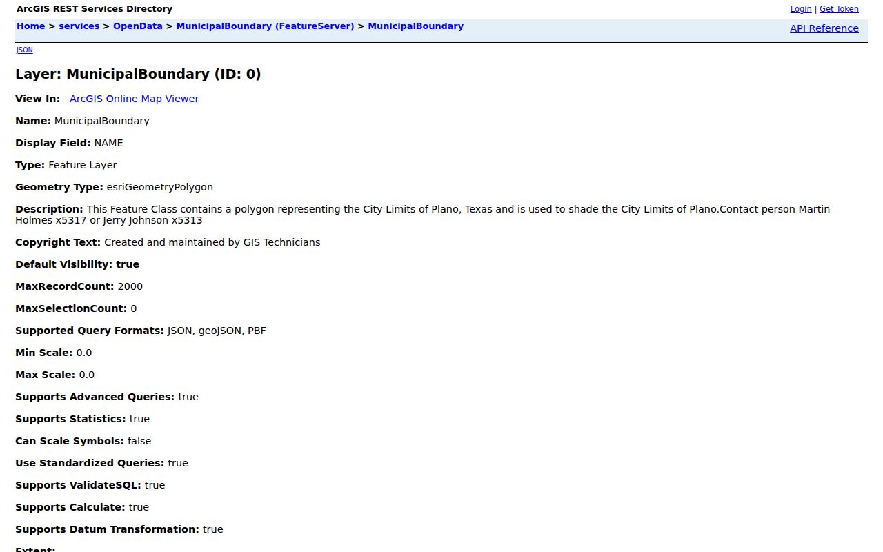
Compare the exact address against this municipal layer after USPS returns the postal result. A ZIP, city name, or map layer alone should never stand in for the parcel record.
Plano Address Keys Beyond ZIP Codes
Four address keys often appear in the same property trail. A situs address is the parcel's physical location. A mailing address is where correspondence goes. A legal description identifies the lot, block, subdivision, or other recorded land description. A property or geographic ID is CCAD's stable appraisal key. ZIP is postal geography. Those fields can overlap, but they should not be substituted for one another. CCAD can connect an address to the legal description, and County Clerk instructions direct address researchers to use that bridge for deed searches.
- ZIP and ZIP+4
- A ZIP identifies a postal delivery area. ZIP+4 adds a more specific delivery segment within that area.
- PO-box ZIP
- A ZIP used for post-office boxes. It does not identify a physical parcel by itself.
- Unique ZIP
- A ZIP assigned for a single organization or large recipient. No Plano-specific example was confirmed in the research.
- Carrier route
- A postal delivery grouping. It is not a city boundary, parcel layer, or resident roll.
Note: CCAD's current advanced-search ZIP field and its result limits were not captured reliably, so a ZIP-wide CCAD search should be used only when the live interface visibly offers it.
Historic Plano Addresses Before ZIP Codes
Older Plano directories usually organize people and places by street and address, not by modern ZIP code. The 1948 and later directory material therefore needs a bridge through the city name, historic street aliases, lot and block, plat, or census enumeration district. Historic Downtown has documented name changes, including Main as K Avenue and Mechanic as 15th Street. The official historic-street-name list is more reliable than assigning a current ZIP to a past record without evidence.
For an historical household or a former street name, city directories, maps, deeds, newspapers, and the Collin County Genealogical Society collections add more useful context than postal filtering. Treat an address as a sequence of forms over time. The present ZIP may help locate the area on a current map, but it does not prove that the same ZIP applied to an earlier directory entry.
Plano ZIP Code Directory Access Routes
When a web lookup cannot answer the question, match the fallback to the record type. USPS offers online, phone-support, and retail-counter routes for postal delivery questions. County GIS offices, city GIS, planning, and addressing staff are routes for mapping or city-boundary questions. CCAD and the County Clerk handle parcel and recorded-land questions. The county ZIP map helps frame a search but is not a decision document. Voter and association portals have their own eligibility and use limits, while the library, CCGS, UNT, and the Texas State Library and Archives Commission can help with historic addresses.
A request under the Texas Public Information Act can seek an existing city or county addressing record, subject to exemptions. It cannot require an office to create a custom ZIP resident list. No public utility or private-delivery address list was located in the research. That absence matters: use the official postal, municipal, parcel, and clerk channels rather than filling a gap with an unsupported list.